Please note: Osher Rainforest will be closed for maintenance Jan. 14–16.
Science News
Water!
June 1, 2012

Where does our water come from? Where does it go? What happens to it along the way? Several recent headlines (and even a Google Earth based film) address our most precious resource—here’s a sampling!
Groundwater
Groundwater was the subject of three studies and several articles in May. Two of the studies look at the effect of pumped groundwater on sea level rise, and both papers agree that groundwater has had a significant impact on global sea level rise. Nature News has details from both the Nature Geoscience study and the Geophysical Research Letters study. Science News does, too, and gives the details in context:
In recent years, sea level has been rising around 3.1 millimeters each year. Besides groundwater depletion, other major contributors include the melting of glaciers and polar ice fields, and the expansion of ocean water as it heats up.
Over at National Geographic Newswatch, Sandra Postel laments the out-of-sight, out-of-mind nature of groundwater. She gives her most endangered aquifer list and includes a video to raise awareness about groundwater depletion.
A study this week in the Proceedings of the National Academy of Sciences highlights the increase in groundwater use in California and Texas. The study’s authors used water level records from thousands of wells, data from NASA’s GRACE satellites, and computer models to study groundwater depletion in the two regions. GRACE satellites monitor changes in Earth’s gravity field that are controlled primarily by variations in water storage.
Irrigation for agriculture is the main cause of groundwater depletion, and the researchers urge more efficient and sustainable irrigation practices before it’s too late.
So little water…
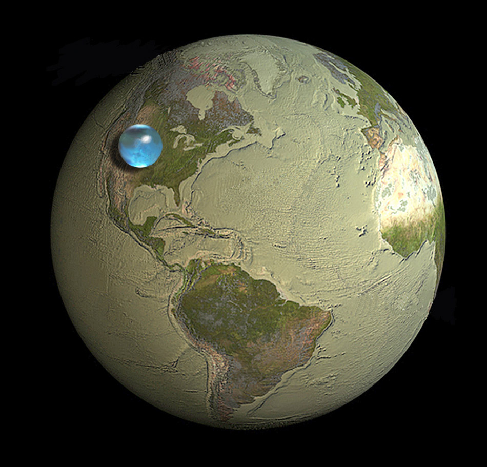
Did you see this fabulous illustration (above, right) of all the world’s water? It was distributed by USGS in mid-May. Please read the fascinating description at their site.
Earlier this week, the Academy and its partners in the Worldviews Network released a short Google Earth based film on global water issues. Like the USGS illustration, it gives perspective of Earth’s available water. It also plunges users into water issues relevant at global and regional scales—especially relevant to the dry American Southwest. You can also play around with the liquid data on your own, using Google Earth.
Local drinking holes
UC Berkeley researchers have developed floating robots to work with smart phones and monitor water flow, especially in river systems like the all-important Sacramento-San Joaquin River Delta. Scientists hope that having a high volume of sensors moving through the water can shed light on processes influenced by water movement, such as the spread of pollutants, the migration of salmon, or the mixing of salt and fresh water in the Delta’s ecosystem. More information is available here.
Thirsty for more?
Scientific American has an in-depth report on the freshwater crisis—including an interesting infographic on water usage by country. Nature News describes a Canadian “laboratory” of lakes on the verge of closure. And an upcoming experiment in the Grand Canyon will see if more water will restore ecosystems for native fish, the New York Times reports.
Image: USGS